
Case Study - Beck Bottom Community Garden - Whitehaven
Introduction
This brief appraisal forms part of 7 sections that Curve 21 are developing to help celebrate the work of the volunteers, explore the connectivity of the garden and help communicate its management requirements. With the kind permission of the group section 2 and section 5 are included on this website. Both are working documents and provide a snapshot of the garden at the time of the survey. The other sections are in the process of being developed.
The Beck Bottom Community Garden has won four Green Flag Awards and is held in high regard by the residents and councillors of Whitehaven.
The garden is approx 4650m2
At its highest point it is 89m and the lowest point is 78m above sea level
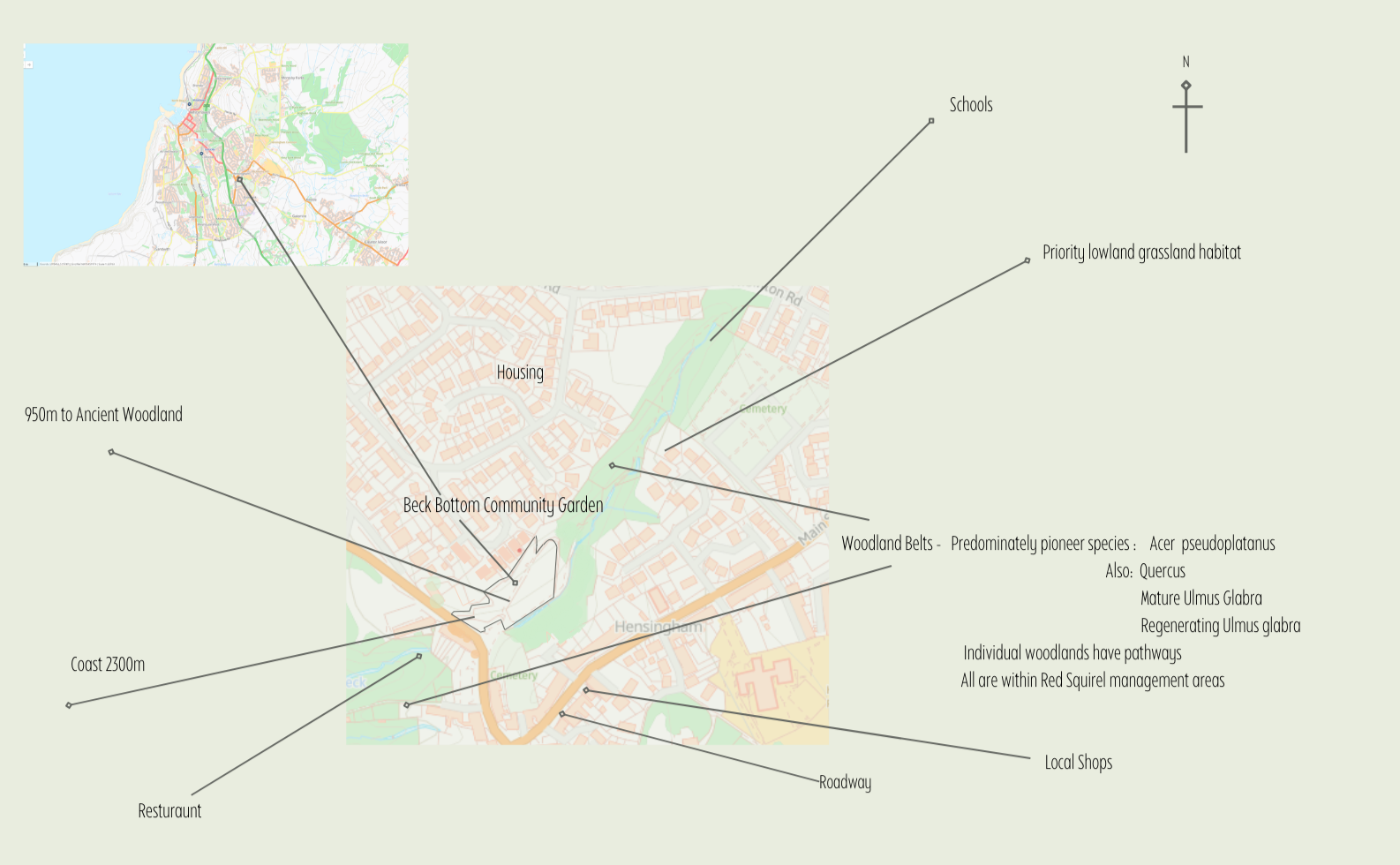
Map highlighting key points of connectivity
Original map source: Magic Maps
Beck Bottom
Case Study Introduction
Connectivity
Ecological Overview
A full ecological evaluation including plant species
The garden runs south westerly following the line of the Snebra Beck
Beck Bottom Community Garden is situated in the Snebra Ghyll, Snebra Beck is a tributary to Pow Beck which flows towards Whitehaven Harbour
The woodland belts in the diagram below form a small part of a network of woodland parcels within the CA28 postcode area
An unmarked footpath follows the Snebra Ghyll eastward up into Devil’s Wood toward Hesingham Common and Priestgill wood
For map see section 2
Social Overview
Whitehaven Parish Population 25,000
The history of the garden is well documented by the group on their website
There is a clear and well placed information board at the car park entrance to the garden
On regular occasions the community garden include the local scout group in the gardens’ management practice
Given the proximity to schools, the community garden could provide a valuable learning resource
For a full social evaluation see section 3
Economic Overview
Please see Management Plan
Additional information will be available in sections 1, 3, 4, 6 and 7 in the near future.
Ecological overview
A full ecological evaluation including plant species and biodiversity audit is documented in Section 3
The garden runs south westerly following the line of the Snebra Beck
The woodland belts in the diagram above form a small part of a network of woodland parcels within the CA28 postcode area
A soil survey was undertaken with the group to establish which wildflower species would most suit the soil
This soil survey used:
data available from online soil maps and defras magic maps
onsite trial pits
soil samples
sedimentation test
The online and onsite data matched, which established that the soil changed slightly depending on elevation
As a result of the testing criteria the group were able to order a selection of wildflower plants that matched the soil condition